Sorting
Source
Katalog centralny
(1)
Form of Work
Mapy
(1)
Status
only on-site
(1)
Branch
Czytelnia Główna (Sokoła 13)
(1)
Author
Horodyski Bogdan (1939- )
(1)
Starzewski Michał
(1)
Year
1980 - 1989
(1)
Time Period of Creation
1901-2000
(1)
1945-1989
(1)
1989-2000
(1)
Country
Poland
(1)
Language
Polish
(1)
Subject
Żeglarstwo
(1)
Subject: time
1901-2000
(1)
1945-1989
(1)
Subject: place
Zalew Zegrzyński (zbiornik wodny)
(1)
Genre/Form
Mapa turystyczna
(1)
Domain
Geografia i nauki o Ziemi
(1)
Podróże i turystyka
(1)
1 result Filter
Map
In basket
Mapa poboczna: Pułtusk, 10x10 cm.
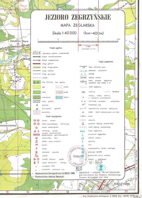
Pod legendą: Opracował i wykonał Michał Starzewski, pod kierunkiem dra Bogdana Horodyskiego Katedra Kartografii UW 1983.
Recto: Wybrane znaki żeglugowe.
Rzeźba terenu: poziomice, punkty głębokości, izobaty.
Verso: blanco.
This item is available in one branch. Expand information to see details.
Copies are only available in the library: sygn. K-867 (1 egz.)
The item has been added to the basket. If you don't know what the basket is for, click here for details.
Do not show it again